Showing posts with label Arctic Circle. Show all posts

Tuesday, November 22, 2011

WOW: Classifying Campgrounds

Star and Vino at the Joshua Tree National Park, a nature preserve
RV camping is very much alive in the US. Out of 30 million RVers in almost 9 million households, about 1.3 million are full timers like Bill and me. We all have almost 2,000 campgrounds to choose from. Cost, location, and facilities may be hard to balance. Being members of Thousand Trails, we can stay at any of their campgrounds for three weeks at a time so it is not that hard. But those three weeks should be as enjoyable as possible so there is still a choice to make. I came up with the following system.

3 quadrants: RV Park, country club, RV haven, and nature preserve
 Construct a chart with an x-axis and a y-axis. Let the x-axis stand for the location of the campground from city to country, going from left to right, and let the y-axis represent amenities and activities from basic to special, going from up to down. We can thus subdivide the space into four quadrants. Going counter-clockwise, at the upper left quadrant is the RV Park, lower left quadrant is the Country Club, lower right quadrant is the RV Haven and upper right quadrant is the Nature Preserve.

camping at the Docks' driveway
RV Park
This is an RV campground within or almost within city limits and has basic amenities or activities, often none. An example is The Oaks at Point South which became our jump-off point to Beaufort, Hilton Head, and Savannah for my friend Dittas when she visited us. But the best example of this category is a hotel in Hermosillo, Mexico which allowed RVs to park at their back parking lot. Another great example is the campground which was within walking distance of the French Quarter in New Orleans!

Walmart RV Park
Now Walmart is America’s best known RV Park! It is said that the average “campsite fee” is $45, the amount one spends for one night of stay. So other grocery chains have followed this excellent strategy. Canadian Tire even has dump stations and fresh water. Belonging to the same class are rest areas (a great number is being shut down due to lack of funds), huge truck stops, and even casinos. But the best example is the driveway of the Rosemary (Bill’s sister) and her husband Jack’s home in Pittsburg,

Country Club 
Palm Springs Country Club
Close to a city, this campground also has many amenities and activities! Where we will be next week, Orlando Thousand Trails in Orlando, Florida is of this type. So is Las Vegas Thousand Trails in Las Vegas, Nevada. They are both just a few miles from great tourist spot and have all the musts: amenities like pool and hot tub, fitness center, mini golf, table tennis and billiards, tennis and other outdoor courts and activities like karaoke, dancing, Texas hold ‘em, pot lucks, movie nights with free popcorn, and concerts.

Nature Preserve 
dry camping at the roadside enroute to the Arctic Circle
Far from a city, this campground may not have amenities or activities but there are fantastic views afforded by its special location. A good example is Kirk Creek Campground of the US Forest Service right at the cliff overlooking the Pacific Ocean in Big Sur! State Parks are the same. The campgrounds within well-known national parks of the National Park Service like Yosemite, Yellowstone, Grand Tetons, Great Smoky Mountains, the Grand Canyon are perennial favorites but require months in advance to book.
Bill relaxing at our campsite in Green Mountain, an RV haven

RV Haven 

Farther from the city, this type of campground is also well equipped with amenities and activities. At Green Mountain Resort in Lenoir, North Carolina, each campsite has a large deck beside a little stream which makes soothing ‘music’ throughout the day. The park also has a lake for fishing and great hiking trails all around, a tennis court, a 9-hole golf course, a large clubhouse with pool and table tennis tables, and eature great concerts and parties. Because it is near the town of Lenoir, we could also use the community center’s gym and spa.

a nature haven in winter...
The statistics of RVers is up by almost 10 percent from 5 years ago! And although the 2,000 campgrounds may not all be full all year-round (northern ones are busy during summer while southern ones are cramped during winter), given the right time of year, they can be literally buzzing with activity. To maximize enjoyment, we need to choose the campground well. After all, it is our home for the duration of our stay. So I have found this classification system very helpful.

a country club in fall
We like country clubs and RV havens best. But we also take short breaks in nature preserves. M’A can comfortably dry camp only for 4 days max (constraints of fresh, black, and grey water tanks and battery power). On the other hand, RV parks are places we use to rest for a night (or as a jump-off point) as we make our way to our next campground. We usually try to limit RV driving to at most 6 hours a day. Driving longer can become pretty tiring for Bill (and really boring for me)!

We looooove the campground infrastructure in the US but we often wonder how it is in Europe or Australia/New Zealand? Can we RV there as well? Watch for the results of our research!

Wednesday, September 8, 2010

Flying to Alaska for a Wedding, Part 1


After one summer month in Alaska last year (please see my last post in  April, Part 1, and my second post in May, Part 2, of this year), we thought we would not be coming back till maybe after five years because it is too costly to get here, whether by land, air or sea! But here we are again because, Cristine, Bill’s youngest, emboldened by our success, finally went to the Net where she met Mitch. On Sept. 6 they ventured on a first date (the same day we were at the Arctic Circle!). Exactly a year after, we are attending their wedding at the Upper Perennials section of the Alaska Botanical Garden!


That morning, low clouds hovered around Cristine’s home in Anchorage.  It was a very pretty sight but not good for a garden ceremony.  Lo and behold!  At around 2-3 PM, the time of their wedding, the sky cleared and smiled at all the pretty blooms around. The small happy party proceeded to have great steaks at the Lone Star SteakHouse.  Then the couple disappeared for their honeymoon at the Alaska Frontier B&B noted for the jacuzzi and sauna right inside the matrimonoial bedroom.


In over a year, from Alaska to Mexico, Yosemite to the Everglades, and the Smokies to Yellowstone, we had seen elk, deer, bear, alligators, python, mountain goats, dall sheep, wolves, etc. but had not seen a single moose!  There was one time in Northern British Columbia but we were not that familiar with our Nikkon SLR yet and he escaped! This time around though, they were right in Cristine’s lovely backyard (Cristine is an exceptinal plant lady) and our rented RV was parked there!  We were so happy!   

You can join a cruise ship through the Inside Passage to get here but not only does it cost a lot but you also lose your freedom to roam the last frontier. Driving your RV through the Alaska Highway allows you to go to more places but, with the cost of gas at $4.50 to a gallon in some parts, it is not only a very expensive way, but also the slowest!  Flying is costly but, since we are holders of Alaska Airlines loyalty cards, we got a companion certificate for just $99 or a little more than buy one get one free.

So we stored M’A ‘turn at Thunderbird Resort in Monroe, Washington and flew to Anchorage on Sept.3. But we had to figure out how to lower the cost of lodging (0 on a cruise or if you brought your RV).  All rooms for two were from $99/night and up plus more $ for a rental car. So we saw the beauty, and the logic, of renting an RV (many Europeans tour North America in RVs)!  Since it was almost off-season, the rates are from $79/night + mileage or, what we finally got, $89/night (unlimited mileage), for any size RV.  
 
We chose a small 22-foot Class C because it would 1) fit nicely in Cristine’s driveway, 2)have reasonable mpg, 3) be easy to maneuver even in city streets, and 4) be self-sufficient to take to places we were not able to go to the year before.  In short, as we have become accustomed to, we rented an apartment and a car all rolled into one.  It was a brilliant decision because when Cristine used it to make her finishing touches.  And when they went for their honeymoon, we also took off to see Soldotna/Kenai, Seward, and Talkeetna (Part 2). 

Next Stops: Soldotna/KenaiSeward, and Talkeetna, Alaskao

Sunday, August 29, 2010

Returning to the Pacific Northwest, Part 1

After fourteen months of cruising North America, to Alaska though the Alaska Highway, to the Arctic Circle, down the West Coast to Mexico and across the Gulf States to the Keys and the Southeast, back west through parts of the Midwest and now up the Northwest, living in 23 American states, 3 Canadian provinces, and 4 Mexican states, we are finally coming ‘home’ to Seattle, Washington. Although it is now only a mailing address, Seattle seems home to us with friends, family, tenants, doctors and agents there.

From Boise, Idaho, we crossed the Blue Mountains, reached Southeastern Washington, and settled in Moses Lake, the largest city (pop: 18T) in Grant County, the potato capital of the country (despite Idaho’s claim!) . Its Saturday Farmer’s Market was spectacular ($1 large watermelons)!  From there, we toured the Grand Coulee Dam near Electric City, the Hanford Reach National Monument near Othello, and the Gingko Petrified State Forest near Quincy, and the county’s  the orchards, gardens, and nurseries.
Grand Coulee Dam is currently the largest dam in North America and the fourth largest in the world, behind Three Gorges in China, Itapúa in Brazil, and Guri in Argentina.  Under construction in Canada, however, is Syncrude Tailings which will become the largest when completed and, along with a few others, will soon greatly change the rankings.  Nevertheless, Grand Coulee is grand, especially with the laser light show in the evening (headline photo above), with the dam as the screen, telling its story.

The unusual topography of Eastern Washington was debated for a long time but is now widely believed to be the result of massive Ice floods from Lake Missoula in Montana. Created by huge glacier fingers from Canada first acting as dams and then giving way, in repeated waves, about 12-15,000 years ago, Lake Missoula is believed to have carried 520 million cubic miles of water (Lakes Ontario and Erie combined). Imagine the power of the water that rushed through the area, finding its way to the Ocean in just 3 days!

The coulees that were formed are unique in the world and on the biggest of them all, the US under FDR invested Fed funds in building, during the Depression, the largest dam in America.  On the way to the dam are interesting sidelights of the flood.  From Moses Lake, you will pass through Soap Lake, an internationally renowned medicinal lake whose healing waters are mineral-rich (creating the look of soap suds around the lake), supposedly effective in curing many ailments.  The Monument to the lake is a sundial of a Native American couple calling the gods to give the lake its healing powers.

Just north of Soap Lake is the Indian Caves of Lenore where petro glyphs can be found. Then several miles to the east is Summer Falls, the result of the releasing of water from the Dam for irrigation during dry months. It is a 165-foot water fall gushing down a dry, treeless landscape, helping to irrigate 650,000 farms (the capacity is for a million). And further north is another waterfall of a different nature: Dry Falls.  As the name implies, there is no water gushing but mere potholes at the bottom, but once, it was the site of the biggest waterfall in the world, at 400 feet tall and three miles wide, double Niagara!

South of Moses Lake, on the other hand, is Othello where the Potholes Reservoir and State Park are. The potholes are smaller versions of the coulees.  Further south is the Hanford Reach National Monument.  Hanford Reach is the outlying delta of the Columbia River and the site of about seven reactors built to produce Plutonium for the WWII atomic bombs.  One in particular, Reactor B (with C close beside it; there is no A), was where the plutonium for the Nagasaki bomb was produced.   At the northern end of the Reach and near Reactor B are the White Bluffs, white cliffs rising out of the Reach for 400 feet.

West of Moses Lake is Quincy.  From Othello, passing through the Bluffs and the Saddle Mountain from whose summit you can get a spectacular view of the Reach, you will reach Quincy after making a quick stop at the Gingko Petrified State Forest across the Columbia.  Petrified logs of spruce, Douglas fir, elm, maple, gingko, etc. are laid out in an interpretive trail. We cut short our visit for there were howling winds that almost blew my 120-pound frame away.  Furthermore, the logs seemed pretty odd, ‘jailed’ onto holes in the ground with thick steel meshes, quite unlike the Petrified National Forest in Arizona.

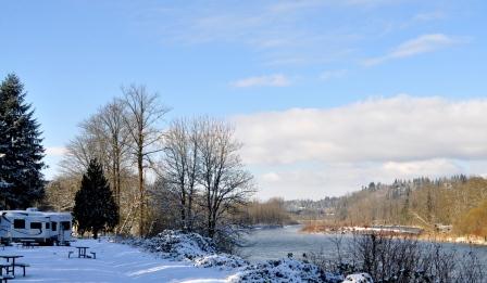
Just north of the Petrified State Forest is the Wild Horses Monument, a spectacular sculpture of 15 wild horses on a cliff overlooking the Columbia Gorge.  The Dave Govedare masterpiece depicts the first horses to roam the earth.  And further north are the Cave B Winery and Inn with its yurts and the 20,000 seat Gorge Amphitheater beside it where Keith Urban was to have a concert the following day.  Lastly, there is the Crescent Bar Resort, a member of the 1000Trails system we belong to.  The resort belongs to a vacation spot on the banks of the Columbia with coulee cliffs all along it. Next time we will stay there!

Next Stop: Fall City, Washington and Anchorage, Alaska          
   

Wednesday, May 5, 2010

Spending Summer in Alaska, Part 2-Denali National Park, Fairbanks, North Pole, and Chicken

We left Cristine, Bill's daughter, in Anchorage with a tinge of sadness in our hearts, knowing that another trip to Alaska will not happen again any time soon. But we were also eager to proceed to Denali National Park, one of the country’s most admired parks. It was established as the first national park to conserve wildlife in 1917.  Its dynamic glaciated landscape supports grizzly bears, caribou, wolves, Dall sheep and moose. And the park is home to North America’s highest peak, the awe-inspiring, 20,320 foot Mount McKinley. At 6 million acres, the park is larger than the State of Massachusetts.


On the way we passed through Wasilla (population: 7,000), the hometown of Sarah Palin.  The normal rumor-mongerers that we were,  we tried to drive around Lake Lucille to chance upon her home.  But we were not lucky.  So we went on to Talkeetna, on the southern end of Denali, where the view of Mt. McKinley was supposed to be best.  Unfortunately, the mountain was hiding from us under the heavy fog cover.  Now we understand that July is the best time to spend summer in Alaska! That night we camped at the nearby Denali State Park, reserving the next 2 at its big brother, Denali National.  


The only way to get to the heart of Denali National Park was to backpack or ride the park buses.  The next day we chose a bus that would take us to the nearest point to Mt. McKinley.  Our bus driver did a good job of spotting wildlife for us.  He stopped when a grizzly bear suddenly appeared roaming on the road right in front of us.  Later he spotted dall sheep grazing at a mountain side, a wolf nestled among the grass by the road, and caribous resting down the valley.  From many sides the majesty of the alpine tundra began to unfold before us. Little did we know that it was a prelude to our Arctic experience.

But when we reached Eielson, the heavy fog behind which Mt. McKinley had been hiding had not lifted at all.  We were denied the spectacle of the ‘High One’ of the 600-mile long Alaska Range.  We could, therefore, not buy any of the merchandise at the gift shop that glowingly said: ‘I am part of the 30% that saw Mt. McKinley’. And even if we stayed a few more nights, the forecast was that it would not clear so we decided to just visit the educational Murie Science Learning Center and the fascinating Iditarod sled dogs training facility on the park and leave for Fairbanks the following day.

Fairbanks is the largest city in the interior region of Alaska, and second largest in the state behind Anchorage. The population of the city is over 35,000 and is home to the University of Alaska Fairbanks, the oldest college in the state. The university was the most exciting place in the city.  From a viewpoint on campus, we finally got a glimpse of Mt. McKinley, albeit 100 miles away.  Then, I saw, for the first time, artichoke plants at the university’s beautiful nursery.  But the most exciting part in campus was chancing upon the large muskoxen at its Large Animals Research Station. 

We stopped by the Fairbanks Visitors Center to ask about how we can see the famed Aurora Borealis and a possible trip to the Arctic Circle.  They told us the northern lights will have a greater probability of being seen in about 5 days (it is visible in Yellowknife, Alaska 10 months in a year).  We also found out that the distance between Fairbanks and the Arctic Circle along Dalton Highway is about 400 miles roundtrip while between Dawson City and the Arctic Circle along Dempster Highway in the Yukon is about 500.  I guess we were not ready to take the big leap so instead we went to North Pole, Alaska the following day.
And there we became kids all over again.  The city and our campground were bedecked with everything Christmas:  Christmas décor hung from all the light posts on the streets, the campground entrance was guarded by  7 reindeer and 20-foot Santa.  Another big Santa with a sleigh was in front of a small park with real reindeer.  Then there was a huge Christmas store on the lot from which we sent Christmas cards to all our siblings, children, and grandkids postmarked North Pole, Alaska.  And, of course, I had my picture taken on Santa’s lap! Truly, there it was Christmas 365 days in a year! 

Finally, we decided to go back to the lower 48 on a different route (not the Alaska Highway) this time…through Chicken, Alaska and the Top of the World Highway to Dawson City in the Yukon.  The road to Chicken, Alaska is all gravel, a prelude to our next several days of travel.  The town’s summertime population is 32 (wintertime it’s 7).  We understand that the town got its name because the residents could not spell the ‘ptarmigan’.  The town is comprised of 2 campgrounds, one with gold-panning activities and the other with a country store.  We stayed at the former which is up the hill.  There we witnessed a spectacular sunset.  And the following day, we resumed our journey through the spectacular Top of the World Highway.

Next Stops:  Dawson City and the Arctic Circle in the post titled, ‘Venturing to the Arctic Circle’

Thursday, February 25, 2010

Venturing into the Arctic Circle

We had just traveled the Top of the World Highway from the town of Chicken, Alaska (population in summer, 32; in winter, 7) to historic Dawson City, the former capital of the Yukon during the Gold Rush. It was a magnificent journey; all that you see during the trip are endless mountains that are golden with alpine tundra in the fall, red, orange, gold, and yellow and the great big, blue sky. The US-Canada border at the Top of the World was unlike any other border town, with nary a soul, just Bill and me and the immigration officer.

To reach Dawson City, all of us, including Star and Vino, rode the ferry. Once there we were surprised to find that the log cabins of 2 famous authors, Jack London and Robert Service, were almost side by side on one street. The city’s ‘golden’ past is kept alive by colorful saloons, thriving general stores, and old theaters in the architecture of the time. We even found the largest gold steam shovel in the world, testament to the town’s importance in gold mining history.

But the day we were to leave for Whitehorse to resume our trip back to the lower 48 through the Alaskan Highway, on impulse we decided to go up the Dempster Highway and drive to the Arctic Circle. When we were at Fairbanks we passed up the opportunity, though the road there was shorter and better. We just told ourselves, we will probably regret it if we did not do it, as only about 3 days and 2 nights separated us from the bragging rights. Besides the forecast of the probability of seeing the Aurora Borealis was good for the next few days where we were.

So we braced ourselves for the rough journey, comforting ourselves that if it looks like Star would not be able to handle the roads, then the option of going back was always open. But we didn’t. Dempster Highway was really what they technically call a dirt-gravel road where rocks are put together and sealed/packed by mud. Some parts were so rough you had to slow down to 5 miles per hour. The fastest Star went was 40; average was probably 25. At the end of the trip Star had to go to the doctor. All her shocks had to be replaced. But it was well worth it.

Going up to the Arctic Circle was a gradual succession of one beautiful scene after another, as the trees of the valley changed into shrubs of the subalpine hills and into the moss, lichens and fungi of the alpine tundra, all in blazing fall colors. We had not seen anything like it before. Some semblance of it was at Denali National Park; more at the Top of the World Highway. But here it was in full regalia. Only a day after, going down from the Circle, the colors seemed even more vibrant, more of everything had simply turned bright yellow.

On the way up we stayed at Eagles’ Nest. A storm had developed, the winds were strong, and the cold was biting.But we survived the night, we kept each other warm, and the sun was up and shining again in the morning. On the way down we chose to stay at a spot we found near where I saw a dall sheep grazing near the river bank the day before. On the other side of the road was a hill ablaze with red, yellow, orange, and gold. Before nightfall we spent the time looking at the different plants up close, to discover how such magnificent tapestry was woven.

The beautiful vastness held our voices silent many times those 2 days. We even saw an elephant rock on top of a hill, fluted mountains, and little blue lakes. Everything seemed to gather, collect, and distill at the Tombstone National Park. Imagine that this is the land first seen by those who migrated from Asia to North America. I thought Canada is simply one beautiful country, this is what pristine is, and there is really One Master Gardener.


Especially when we reached the Arctic Circle at lat 66 degrees 33 north.  There was no one in sight for miles around. We were alone at the arch proclaiming that special spot on earth. You just know that it is a special place; there were practically no plants for miles before. It was so cold and the winds were biting that we could not stay long.
Shivering, we hurriedly put our camera on its timer, placed it on the lone picnic table and had the photo of our life ‘taken’.